Miles: 8.75 (2 days)
Q to R (Points include a couple of short days before)
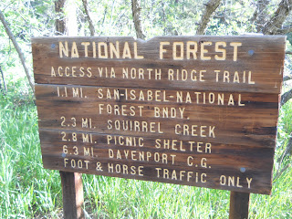
The Squirrel Creek trail starts in Pueblo Mountain Park. It turned into a history lesson along the way. First this old sign at the trail head. The trail was not marked at all except with a VERY infrequent "I" blaze in the trees.
A lot of times we quickly take these pictures on a high point and then move on. We've decided not to include those pictures unless we actually sit there awhile.
This bird just looked like it was having fun gliding around.
This is where the history lesson began. We were planning to have lunch here and go on. But the Squirrel Creek had water in it this time. It was a short distance to the left of the picture. This shelter is the Carhart design and one of the first shelters made in the country. The fireplace is original, but the wooden part washed away in a flood. It was rebuilt in the 80's. It's hard to believe, but a road used to run here. There are old pictures of cars parked here.
We decided to spend the night.
The fireplace was made in 1927. (An optical illusion can make it look like 1937.)
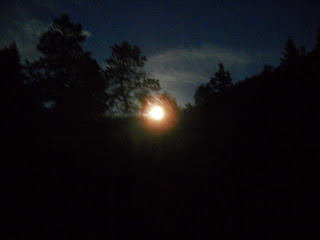
This was supposed to be the brightest full moon of the year. It looked almost like a sunrise. Mares tails. Yes, it did rain late in the afternoon.
Fun moving the camera while taking a picture of the moon,
The fireplace was great. After the fire was going a couple hours, the stones got warm and it was very toasty.
Going on the next day, we crossed this stream many times. The trail went back and forth across it. After awhile, we just started walking through the water. It was easier and quicker.
There were old campsites all along the 4 miles or so of the trail. It was the nations first campground. The trail is on the National Historical Record. So don't take anything. There are big fines for that.
We must have taken a wrong turn because this is where the trail ended.
I went over this on the way home.
There were a few of these and more holes.
Each campsite had a fire pit. Several families were supposed to camp around each one.
Virtual Hike End of Day Picture
TransAmerica Virtual Hike
Due to a bad couple of weeks, I lost some places. Down to 9th in the top 20. Worse, I lost a lot of miles. I'll have to see if I can catch up gradually. Maybe toss in a big day this weekend if I have the time. It was real tempting to say screw this program as it was down for a week. But I like the motivation from other participants.
| Name | Distance |
| BernieS | 992.6 mi |
| JohnZ | 984.7 mi |
| AshleyA | 971.5 mi |
| AnnF | 948.9 mi |
| PatM | 924.4 mi |
| JohnA | 897.2 mi |
| DanaA | 888.6 mi |
| johnd | 886.0 mi |
| GaryT | 881.6 mi |
| LT | 859.8 mi |
| StaciR | 858.8 mi |
| MarilynrH | 839.0 mi |
| SusanP | 836.4 mi |
| sarah w | 835.1 mi |
| SHIRLEYE | 832.9 mi |
| RebeccaJ | 825.7 mi |
| JoyJ | 816.3 mi |
| DavidG | 811.5 mi |
| RamonaH | 803.7 mi |
| LoreneE | 796.7 mi |


No comments:
Post a Comment